


Below is an executive summary of the Bachelors’ thesis research conducted by Sujata Ramkhelawan in 2019 at the Environmental Science Department of the Anton de Kom University
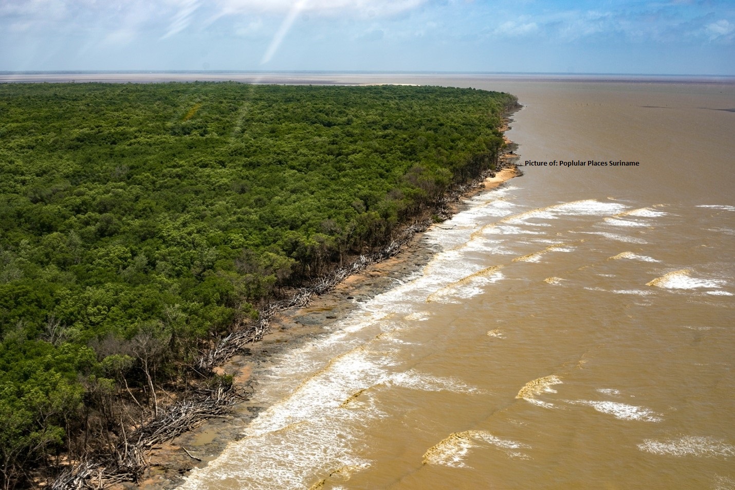
The mangrove forest along the dynamic mud coast of Suriname provides the most productive ecosystems and supplies several economically significant products, but also ensure stabilization of the coast. Despite most of the country’s mangrove forests are having a protected status as Multiple Use Management Areas (MUMA) and/or as Nature Reserves, still, two-thirds of Suriname’s mangroves are facing significant problems caused naturally or by humans. Therefore, monitoring a spatiotemporal distribution of the mangrove forest is crucial for Suriname.
The research objectives were to map the extent of the mangrove forest cover in the Paramaribo and Coronie region and to identify the changes in 2009, 2014 and 2017 by using Landsat imagery data. The mangrove classification process included four main steps: pre-processing, core-processing, post-processing and change detection analysis. Accuracy assessment was done by comparing the classification results with reference data, which indicated an overall accuracy between 97 % – 100 % for Paramaribo and 98 % – 100 % for Coronie. In Paramaribo, the change of mangrove to non-mangrove during the period 2009-2017 was 205 ha, 0.18 % of the Suriname mangrove area, and regenerated of about 230 ha, 0.20 %. The changes in Coronie during the same period represented a loss by approximately 3847 ha, 3.35 % of the Suriname mangrove area, but recovered about 2452 ha, 2.13 %. The “Weg naar Zee” and the “Sea Dike” region were the locations that were most affected by heavy coastal erosion, extensive land use for urbanization, agriculture and dike construction. These threats led to a naturally reducing vitality of the mangrove forest cover. This study demonstrated the effectiveness of the method used for change detection in the mangrove forest through historical assessment and the results could provide planners with quantitative data for monitoring the mangrove forest cover.
Click on the link to gain access to the full report